Tattnall County History Articles
River Known By Many Names
Among the many nomenclature changes that have occurred in our local geographical history is the name for the Altamaha River. Some early references to the river clearly designate it as the “Alatamaha” including this one by famed naturalist William Bartram in 1776.
Bartram wrote, “But, before I leave the Alatamaha, we will proceed to give a further and more particular account of it. It has its source in the Cherokee mountains, near the head of the Tugilo, the great west branch of the Savanna, and, before it leaves them, is joined and augmented by innumerable rivulets; thence it descends through the hilly country, with all its collateral branches, and winds rapidly amongst the hills two hundred and fifty miles, and then enters the flat plain country, by the name Oakmulge; thence meandering an hundred and fifty miles, it is joined on the east side by the Ocone, which likewise heads in the lower ridges of the mountains. After this confluence, having now gained a vast acquisition of waters, it assumes the name Alatamaha, when it becomes a large majestic river, flowing with gentle windings through a vast plain forest, near an hundred miles, and enters the Atlantic by several mouths.”
By 1804 the more common spelling of “Altamaha” as well as the one used by Bartram is seen in writings including one by Aaron Burr who refers to the location of St. Simons Island. Burr wrote in a letter, “This Island is forty-five miles long, and it lies north of the mouth Altamaha, commonly spelled Alatamaha. It is, in fact, twelve and a half miles in length, and lies southeast of that river. Its width is about two and a half miles.”
That would seem to give us the skinny on the spelling of the river….two competing ones. But, that would be too easy. History tells us there was at least one other spelling as well.
Predating Bartram and Burr’s references is one by Irish born poet Oliver Goldsmith in his famous poem The Deserted Village. Goldsmith’s Irish brogue may have had something to do with his spelling or perhaps he was closest to the native pronunciation.
It also bears noting that Goldsmith wrote the poem in 1770 after he had moved to London and that he never actually visited America. Where he got the reference from is another mystery.
“Ah, no. To distant climes, a dreary scene,
Where half the convex world intrudes between,
Through torrid tracts with fainting steps they go,
Where wild Altama murmurs to their woe.
Far different there from all that charm'd before,
The various terrors of that horrid shore;
Those blazing suns that dart a downward ray,
And fiercely shed intolerable day;
Those matted woods, where birds forget to sing,
But silent bats in drowsy clusters cling;
Those poisonous fields, with rank luxuriance crown'd,
Where the dark scorpion gathers death around;
Where at each step the stranger fears to wake
The rattling terrors of the vengeful snake;
Where crouching tigers wait their hapless prey,
And savage men, more murd'rous still than they;”
Goldsmith’s spelling is mentioned in Margaret Davis Cate’s 1930 history of the Brunswick area called Our Todays and Yesterdays and is claimed to be the proper one. Cate was a long time historian of the Golden Isles. According to Cate the river is rightly called the “Altama”, and the name is accurately derived from the location of an Indian village called Tama at the forks of the Ocmulgee and Oconee Rivers. Coastal Indians traveled to this village by way of the river that they called “the way to the Tama country”, thus giving it the name Altama. There was an ancient east-west Indian trail that crossed at the confluence of the Ocmulgee and Oconee. Indian princess Mary Musgrove, who served as General James Edward Oglethorpe’s interpreter referred to this location as “The Forks” and is reported to have maintained a trading post there. Oglethorpe, of course was the founder of Georgia. Musgrove owned extensive tracts of land and operated at least one trading post on the river. Excavations by archeologists from the University of Georgia in 2003 revealed evidence of a Musgrove trading post in Wayne County.
From Cate’s writing it appears the people of Brunswick take the spelling of the river very seriously. There was an antebellum plantation named “Altama” located near the river and a major road named “Altama” Avenue runs through the city today.
According to the Sherpa Travel Guide, the name Altamaha, is properly pronounced All´-ta-mahaw´, and is derived from “an immigrant Yamassee Indian group descended from an interior chiefdom originally known as Altamaha or Tama, located on the Oconee River just below Milledgeville.” This particular area was visited by Hernando de Soto in 1540.
The Sherpa Guide tells us that Altamaha chiefdom was forced into slavery, rebelled and eventually settled in St. Augustine until it evacuated with the Spanish to Cuba in 1763.
The Spanish name for the river according to early maps of the region was Rio de Santa Isabel, referring to an early mission called Santa Isabel de Utinahica, established in the Timucuan chiefdom of Utinahica located at the forks of the river near present-day Lumber City.
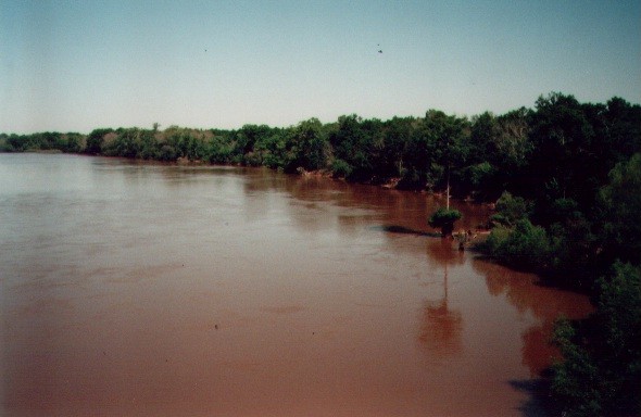
Today there are reportedly more than a thousand Indian sites along the river, which testify to the river’s importance for travel and sustenance. Early colonists found the river just as useful for commerce and transportation as the Indians did. In fact, the Altamaha served as the equivalent of today’s interstate highways for inland settlers taking their wares to market on the coast. The mighty virgin timbers that were harvested from the pinelands were barged down to Darien along “the mighty muddy.” The history of the timber rafting tradition is a vital part of the Altmaha River basin culture.
When newcomers see the differing spellings of the river on historical markers, road names and state parks, we can understand their confusion. Altama, Alatamaha and Altamaha all refer to the same mighty river. Some have called it simply: “The Mighty Muddy”. It might best be said that the varied spellings are a testament to the varied people who have lived on and loved the great river.